Mountains rising straight out of the sea, glaciers calving into quiet bays and penguin colonies a few steps from the shore. The Antarctic Peninsula is where almost every Antarctica cruise spends its days on the ice, and it is easy to see why.
Look at a map of Antarctica and the Peninsula is the thin, crooked finger pointing up towards South America. It runs for well over 1,000 km from the main body of the continent, a spine of mountains, many of them over 2,000 metres high, buried under ice that pours down to the sea in hundreds of glaciers. Its west coast is broken into bays, channels and fjords and fringed with islands, and that sheltered western side is where expedition ships spend most of their time.
The Peninsula is the warmest, most accessible and most varied part of Antarctica. It lies outside the Antarctic Circle for most of its length, which means a little more open water, a few more weeks of summer and a great deal more life than the interior of the continent. It is also a short sail from the South Shetland Islands across the Bransfield Strait, and around two days from Ushuaia across the Drake Passage. That is why almost every Antarctica cruise includes it.
What strikes most people first is the scale and the silence. Mountains seem close enough to touch and turn out to be ten miles away. Icebergs the size of churches drift past in blue and white, and on a calm day the water is so still that it mirrors the peaks above it. Then a glacier cracks somewhere across the bay, a penguin colony starts to chatter, and you realise it is not silent at all.
Who It Belongs To
The Antarctic Treaty and IAATO
Nobody owns Antarctica. The Antarctic Treaty was signed in Washington on 1 December 1959 by the twelve nations then active on the continent, including the United Kingdom, and came into force in 1961. It sets the continent aside for peace and science, bans military activity and puts territorial claims on hold. Britain, Argentina and Chile all have overlapping claims on the Peninsula, which is why you will see research stations from all three, but under the Treaty none of those claims is pressed. More than fifty countries have now signed. The 1991 Madrid Protocol added strict environmental rules, including a ban on mining.
Tourism is managed through the International Association of Antarctica Tour Operators (IAATO), founded in 1991, which all the expedition lines we work with belong to. IAATO's guidelines are why visits feel so carefully managed. Ships carrying more than 500 passengers cannot land anyone at all. No more than 100 people may be ashore at one site at a time, landings are scheduled between ships so you rarely see another vessel, and you keep at least 5 metres from penguins and seals. Before your first landing every coat, bag and walking pole is vacuumed and every boot washed, so that no seeds or soil reach the continent. It takes a little time, and nobody minds once they understand why.
Where You Might Go
Landing sites on the Antarctic Peninsula
No two Peninsula voyages are the same. The Captain and Expedition Leader choose each day's stops according to weather, ice and the other ships in the area, so treat what follows as a list of possibilities rather than a fixed itinerary. These are the places we hear about most often from our clients when they come home.
The Gerlache Strait
The Gerlache Strait is the broad, sheltered waterway that separates the Palmer Archipelago from the Danco Coast of the mainland, and it is the main street of a Peninsula voyage. It is named after Adrien de Gerlache, whose ship Belgica explored here in 1898 with a young Roald Amundsen as first mate. Belgica later became trapped in the pack ice, and her crew became the first to spend a winter in the Antarctic. The strait is a favourite feeding ground for humpback whales from midsummer, and many of the best landings open off it.
Neko Harbour and Andvord Bay
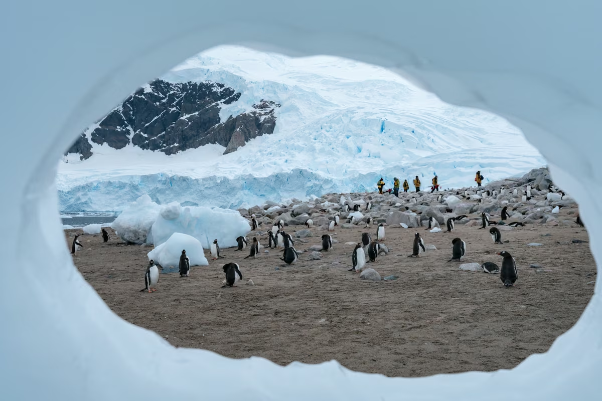
Neko Harbour sits deep inside Andvord Bay and is one of the classic places to set foot on the Antarctic mainland itself. A gentoo colony is spread across the rocks above the beach, and a short walk uphill gives you a view over a huge, active glacier front that calves regularly into the bay. The Expedition Team keep the landing area well back from the waterline for exactly that reason. The harbour takes its name from the Neko, a Scottish whaling factory ship that worked here in the early twentieth century.
Paradise Bay and Brown Station
Whalers named it Paradise Harbour, and on a still day you will understand why. The bay is ringed by glaciers and steep peaks and is a wonderful place for a small boat cruise among the ice. On its shore stands Almirante Brown, a summer only Argentine research station, and when it is permitted guests can land nearby and climb the slope behind it for a view across the whole bay. Nearby, Chile's González Videla station stands among a gentoo colony on Waterboat Point.
Cuverville Island
Cuverville is a small, high island at the entrance to the Errera Channel and home to one of the largest gentoo penguin colonies on the Peninsula, several thousand pairs strong. The beach is often lined with grounded icebergs, which makes the boat ride in as memorable as the landing, and leopard seals sometimes patrol the shallows looking for an unwary penguin.
Danco Island
Just across the Errera Channel, Danco Island has a gentoo colony that climbs all the way to the island's summit, around 180 metres up. Walking up alongside the penguin highways, the paths the birds wear into the snow, is good exercise, and the view from the top over the channel and its icebergs is one of the finest on the coast.
Orne Harbour
Orne Harbour is a small cove on the Danco Coast, overlooked by steep cliffs. When snow conditions allow, guests climb a steep path to a saddle on the ridge where a colony of chinstrap penguins nests, with the Gerlache Strait spread out below. It is a proper hike in snowshoes or boots, but it is also one of the few chances to see chinstraps on the mainland.
Wilhelmina Bay
Wilhelmina Bay is less a landing than a place to watch. In late summer it can be full of feeding humpback whales, so much so that expedition staff sometimes call it Whale-helmina Bay, and ships will slow down and spend time among them. Expect small boat cruising rather than a landing here.
Port Lockroy and the Penguin Post Office
Port Lockroy, on tiny Goudier Island off Wiencke Island, was a British wartime base set up in 1944 during Operation Tabarin, the secret mission that started Britain's permanent presence in Antarctica. Its main building, Bransfield House, has been restored as a museum by the UK Antarctic Heritage Trust, which staffs the site every summer. Inside you will find the 1950s bunk room, kitchen and radio room just as they were. The Trust also runs the Penguin Post Office, and sending a postcard home with a British Antarctic Territory stamp is a ritual almost nobody skips. Gentoo penguins nest right around the buildings. In the 2025/26 season the team counted 445 breeding pairs on the island and handled around 50,000 postcards.
Damoy Point
A short distance from Port Lockroy on Wiencke Island, Damoy Point has a small blue hut from the 1970s that was used as a summer air facility for flights south to Rothera, now preserved as a historic site. It is a good spot for snowshoeing on the gentle slopes behind, with gentoos nesting among the rocks.
The Lemaire Channel
The Lemaire Channel is about 11 km long and only around 1.6 km wide at its narrowest, with steep mountain walls rising hundreds of metres on both sides. Sailing through it on a calm day, with ice floes nudging the bow and crabeater seals hauled out on them, is one of the great moments of any Antarctica cruise. It is often blocked by ice, though, so it can never be promised. Photographers have nicknamed it Kodak Gap, which tells you everything.
Petermann and Pleneau Islands
South of the Lemaire Channel, in the Penola Strait, lie two of the most rewarding landings on the coast. Petermann Island has colonies of both gentoo and Adélie penguins as well as blue eyed shags, and it is where the French explorer Jean-Baptiste Charcot wintered his ship Pourquoi-Pas? in 1909. Nearby Pleneau Island sits beside a natural trap for grounded icebergs, sometimes called the iceberg graveyard, where wind and current have carved the ice into arches and towers. It is a superb place for a small boat cruise, and elephant seals are often found lazing on the beaches.
Classic Antarctica
Highlights of Antarctica
Buenos Aires · Ushuaia · Antarctic Peninsula · 12 Days
The simplest way to experience the Peninsula is our most popular voyage. After a night in Buenos Aires you fly to Ushuaia, cross the Drake Passage on the hybrid powered MS Fridtjof Nansen and spend up to five days exploring sites like Neko Harbour, Cuverville Island and the Gerlache Strait.
There are fourteen departures between October 2026 and March 2027, so it is easy to find a date that suits.
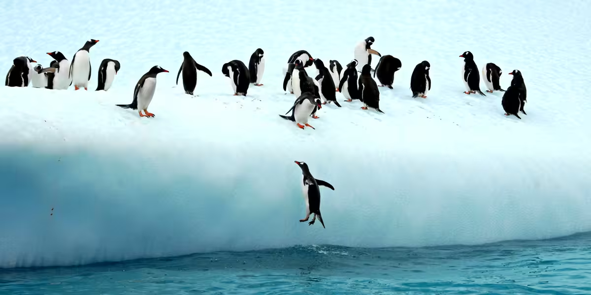
Three species of penguin breed along the Peninsula. Gentoos, with their bright orange bills and white head flashes, are the most widespread and the most likely to be your first. Chinstraps, named for the thin black line under the chin, are more common on the South Shetlands and the northern tip. Adélies, the classic dinner jacket penguin, prefer colder water and are found mainly around the Antarctic Sound and further south at sites such as Petermann Island. Emperors do not breed on the western Peninsula, although a stray juvenile on an ice floe is not unheard of.
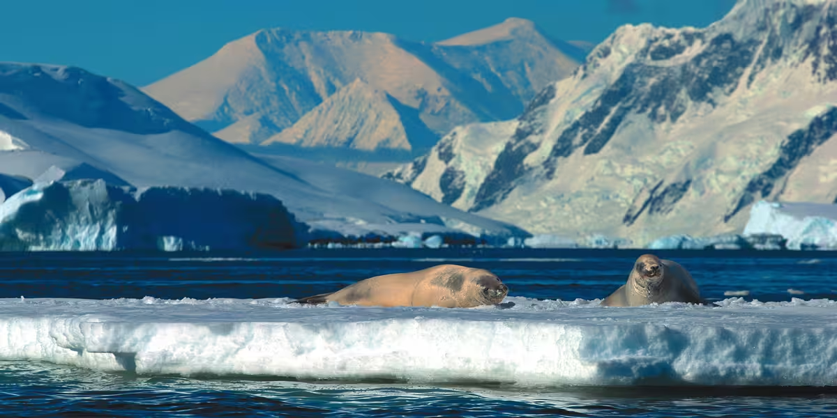
Crabeater seals are the seals you will see most often, resting on floes in groups, and despite the name they live almost entirely on krill. Weddell seals lie on the ice like plump grey sausages and barely lift their heads. The leopard seal, long and reptilian with a huge head, is the predator everyone hopes to see, and often does around penguin colonies. Antarctic fur seals and southern elephant seals arrive in growing numbers in late summer.
From December onwards humpback whales return to feed on the krill swarms, and by February and March they can be everywhere, sometimes sleeping at the surface or coming right up to the expedition boats. Antarctic minke whales slip quietly between the floes, and orcas are seen on many voyages. Overhead you will find skuas, kelp gulls, snowy sheathbills, Antarctic terns, cape petrels and, if you are lucky, the pure white snow petrel. Our Antarctic wildlife guide covers each species in more detail.
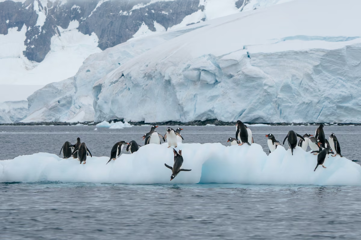
Neko Harbour through a window in the iceGentoo penguins on the ice in Paradise Bay
Expedition Life
What a landing day is really like
The day usually starts early, with a wake up call from the Expedition Leader over the ship's speakers and a quick look out of the window to see what the night has brought. Breakfast is followed by a briefing on the morning's site: what you will see, where you can walk and which areas are off limits to protect nesting birds.
Guests go ashore in groups, so you will be called by colour or number to the boarding area. You pull on your waterproofs and the rubber boots the ship lends you, scan your card so the crew know exactly who is off the ship, step through the boot wash and climb down into a small expedition boat. The ride in takes a few minutes. Most landings are wet, which simply means stepping out into ankle deep water on a shingle beach with a guide holding the boat steady.
Once ashore you are free to wander within the area the team have marked out, usually for an hour or so. Some people sit quietly beside a colony and watch penguins steal stones from each other's nests. Others climb to a viewpoint or join a guided walk. Then it is back to the ship for lunch while she repositions, and in the afternoon there is a second outing: another landing, a cruise among the ice, or kayaking for those who have booked it. Evenings bring a recap in the lounge, where the team explain what you saw and plan the next day, followed by dinner as the light softens over the mountains. In December and January it barely gets dark at all.
If you want more detail on clothing, fitness and health requirements, see our practical information page, and for the daily rhythm on board, our life on board guide.
Timing
When to visit the Antarctic Peninsula
The season runs from late October to March. In early season (late October and November) the snow is deep and clean, the sea ice is still breaking up and penguins are courting and building nests. December and January bring the longest days and the first chicks. February and March are the months for whales, with fat, noisy penguin chicks moulting into adult plumage and long, colourful sunsets. Our when to go guide sets it out month by month.
More Time on the Ice
Iconic Antarctica, The Explorer's Route
Buenos Aires · Weddell Sea · Gerlache Strait · 16 Days
With up to nine days in Antarctica, this voyage on MS Roald Amundsen covers far more of the Peninsula: the South Shetlands, the Antarctic Sound and the Weddell Sea, then south through the Gerlache Strait to the Penola Strait, or the Lemaire Channel when the ice allows.
Antarctica & Patagonia Expedition, 18 days, new for 2027/28, from Valparaíso through the Chilean fjords, with up to 4 days in Antarctica in early spring
Do you actually set foot on the Antarctic continent?
Yes, on most voyages. Many Peninsula landings are on offshore islands, but sites such as Neko Harbour, Brown Bluff and Orne Harbour are on the Antarctic mainland itself, and the Expedition Team will try to include at least one continental landing whenever the weather and ice allow.
How cold is the Antarctic Peninsula in summer?
Milder than most people expect. During the cruise season daytime temperatures on the Peninsula are usually between about minus 5°C and plus 5°C. Wind makes the biggest difference, so windproof and waterproof layers matter more than sheer bulk.
Can I send a postcard from Antarctica?
Yes, if your ship visits Port Lockroy. The UK Antarctic Heritage Trust runs the Penguin Post Office there during the summer season, and postcards bought on site are franked with a British Antarctic Territory postmark. They can take several weeks, sometimes months, to arrive.
Is the Lemaire Channel always included?
No. The channel is narrow and is often blocked by ice, especially early in the season. The Captain decides on the day whether a transit is safe, and if it is not the ship will usually explore another area such as the Penola Strait or the Gerlache Strait instead.